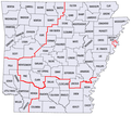
File:Arkansas Scout Map.png
Appearance

Size of this preview: 717 × 599 pixels. Other resolutions: 287 × 240 pixels | 574 × 480 pixels | 773 × 646 pixels.
Original file (773 × 646 pixels, file size: 97 KB, MIME type: image/png)
File history
Click on a date/time to view the file as it appeared at that time.
| Date/Time | Thumbnail | Dimensions | User | Comment | |
|---|---|---|---|---|---|
| current | 16:09, 27 February 2013 |  | 773 × 646 (97 KB) | ARTEST4ECHO | Added Council Names |
| 15:21, 27 February 2013 |  | 735 × 653 (83 KB) | ARTEST4ECHO | Change mind. Am going to do thing differently. | |
| 20:29, 22 February 2013 |  | 735 × 648 (87 KB) | ARTEST4ECHO | == {{int:filedesc}} == {{Information |Description={{en|1=Map of council and district locations in Arkansas}} |Source={{Derived from|82ARGovCounties.PNG|display=50}} |Date=2013-02-22 20:27 (UTC) |Author=*File:82ARGovCounties.PNG: [[User:Tennisace1... |
File usage
The following page uses this file:

